Best time to hike: Anytime of year
Jump-off: Burnham Park or Green Valley, Brgy.
Dontogan, Baguio City
Days required / Hours to summit: 1 day / 2
hours (ST) 3 hours (C)
Classification: Minor Climb
Difficulty: 2/9; Date of my hike: Dec. 31, 2013 with temp. of 1.5 to 11deg.
Classification: Minor Climb
Difficulty: 2/9; Date of my hike: Dec. 31, 2013 with temp. of 1.5 to 11deg.
 |
Mt. Sto Tomas: 2,256 MASL, LLA: 16° 20.12N, 120° 33.661E.
|
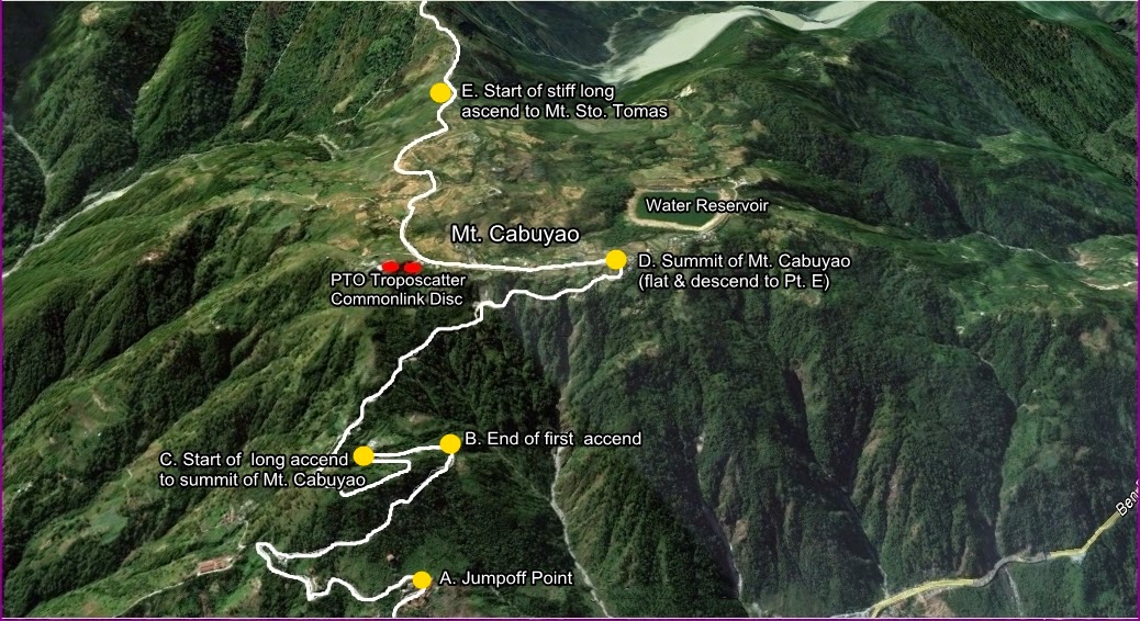
6. After 1.5 to 2 hrs. of hike an 17 km. you are now on top of (the world) Mt. Cabuyao.
7. Try to reach the summit before the sunrise and wait for the sunrise at the top
8. Jeepney ride going down is available 9 and 11am only. No guaranty.
| View from the top. |
 |
| Going farther up to Mt. Sto. Tomas |

 |
| To the summit of Mt. Sto. Tomas |
From the summit of Mt. Sto. Tomas, you have a choice of extending your hike
taking a different route on the trek down via the Twin Peak trail and exiting at
Camp 2-Kennon Road or via Saddle-Bued River trail exiting at the Hilltop, Camp 6,
Kennon Road, before the Lion's Head, going to Baguio city.


No comments :
Post a Comment